
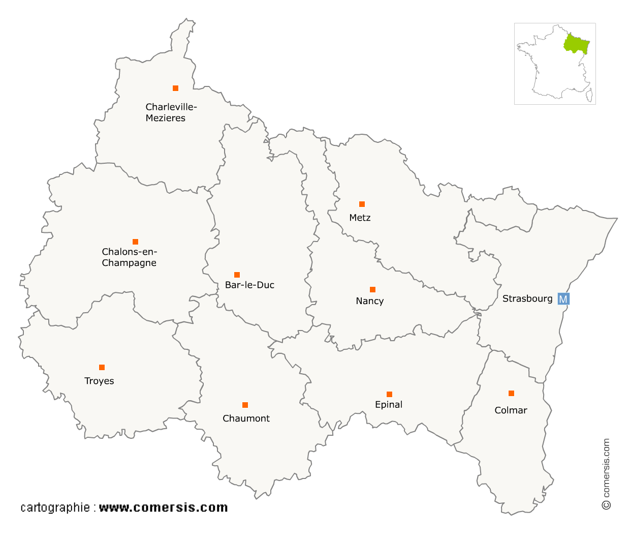
Associations en région Grand-Est
1 748 associations sont référencés sur la région Grand-Est
Vous recherchez une organisation associative dans le Grand-Est ?
La région Grand-Est représente 5% des associations de France.
C'est le département du Bas-Rhin qui compte le plus d'associations dans le Grand-Est.
C'est le département du Bas-Rhin qui compte le plus d'associations dans le Grand-Est.
Associations dans la Marne (51)
Secteur de Reims
Indice d'implantation
| Commune | Nb Pro | Habitants | Distance | |
|---|---|---|---|---|
| Reims - 51100 | 128 | 182592 | 0,0 | km |
Secteur de Châlons-en-Champagne
Indice d'implantation
| Commune | Nb Pro | Habitants | Distance | |
|---|---|---|---|---|
| Châlons-en-Champagne - 51000 | 52 | 44899 | 0,0 | km |
| Saint-Martin-sur-le-Pré - 51520 | 1 | 725 | 2,7 | km |
| Fagnières - 51510 | 2 | 4604 | 3,2 | km |
| l'Épine - 51460 | 1 | 585 | 8,2 | km |
| Nuisement-sur-Coole - 51240 | 1 | 337 | 9,8 | km |
| Saint-Germain-la-Ville - 51240 | 1 | 642 | 10,3 | km |
| Courtisols - 51460 | 2 | 2472 | 11,9 | km |
| Condé-sur-Marne - 51150 | 1 | 760 | 16,5 | km |
| Somme-Vesle - 51460 | 2 | 424 | 17,1 | km |
| Soudron - 51320 | 1 | 311 | 17,6 | km |
| Poix - 51460 | 1 | 76 | 19,2 | km |
| Mourmelon-le-Grand - 51400 | 1 | 5339 | 20,4 | km |
| Suippes - 51600 | 3 | 3998 | 22,9 | km |
| Sommesous - 51320 | 1 | 525 | 27,0 | km |
| la Chapelle-Felcourt - 51800 | 1 | 57 | 30,2 | km |
| Sainte-Menehould - 51800 | 2 | 4290 | 41,9 | km |
Secteur de Épernay
Indice d'implantation
| Commune | Nb Pro | Habitants | Distance | |
|---|---|---|---|---|
| Épernay - 51200 | 18 | 23413 | 0,0 | km |
| Ay - 51160 | 4 | 5841 | 3,5 | km |
| Cumières - 51480 | 1 | 786 | 3,9 | km |
| Cramant - 51530 | 1 | 880 | 6,8 | km |
| Avenay-Val-d'Or - 51160 | 1 | 925 | 7,3 | km |
| Germaine - 51160 | 1 | 514 | 9,6 | km |
| Œuilly - 51480 | 1 | 612 | 12,3 | km |
| Vertus - 51130 | 2 | 2444 | 15,7 | km |
| Montmort-Lucy - 51270 | 1 | 581 | 17,0 | km |
| Vouzy - 51130 | 1 | 298 | 17,3 | km |
| Val-des-Marais - 51130 | 1 | 568 | 21,9 | km |
| Dormans - 51700 | 4 | 2886 | 23,3 | km |
| Baye - 51270 | 1 | 408 | 25,3 | km |
| Bannes - 51230 | 1 | 289 | 26,8 | km |
| Fère-Champenoise - 51230 | 1 | 2258 | 32,3 | km |
| la Villeneuve-lès-Charleville - 51120 | 1 | 122 | 32,4 | km |
| Montmirail - 51210 | 1 | 3691 | 36,0 | km |
| Corroy - 51230 | 1 | 159 | 38,2 | km |
| Sézanne - 51120 | 1 | 5102 | 39,8 | km |
| Angluzelles-et-Courcelles - 51230 | 2 | 147 | 43,1 | km |
| Esternay - 51310 | 1 | 1932 | 45,2 | km |
Secteur de Tinqueux
Indice d'implantation
| Commune | Nb Pro | Habitants | Distance | |
|---|---|---|---|---|
| Tinqueux - 51430 | 2 | 10023 | 0,0 | km |
| Saint-Brice-Courcelles - 51370 | 2 | 3464 | 1,1 | km |
| Bezannes - 51430 | 1 | 1494 | 3,4 | km |
| Cormontreuil - 51350 | 4 | 6065 | 5,7 | km |
| Gueux - 51390 | 1 | 1704 | 6,0 | km |
| Taissy - 51500 | 1 | 2261 | 8,7 | km |
| Villers-Franqueux - 51220 | 1 | 302 | 9,1 | km |
| Rosnay - 51390 | 1 | 328 | 9,3 | km |
| Bouilly - 51390 | 1 | 182 | 9,5 | km |
| Brimont - 51220 | 1 | 437 | 10,2 | km |
| Rilly-la-Montagne - 51500 | 1 | 1025 | 10,5 | km |
| Witry-lès-Reims - 51420 | 2 | 4833 | 10,6 | km |
| Hermonville - 51220 | 1 | 1486 | 11,0 | km |
| Puisieulx - 51500 | 1 | 401 | 11,2 | km |
| Bourgogne - 51110 | 1 | 992 | 12,3 | km |
| Verzy - 51380 | 2 | 1037 | 17,2 | km |
| Val-de-Vesle - 51360 | 1 | 884 | 19,0 | km |
| Arcis-le-Ponsart - 51170 | 1 | 298 | 21,5 | km |
| Prosnes - 51400 | 1 | 520 | 23,0 | km |
| Fismes - 51170 | 2 | 5418 | 23,4 | km |
| Bétheniville - 51490 | 1 | 1244 | 27,9 | km |
Secteur de Vitry-le-François
Indice d'implantation
| Commune | Nb Pro | Habitants | Distance | |
|---|---|---|---|---|
| Vitry-le-François - 51300 | 8 | 13174 | 0,0 | km |
| Thiéblemont-Farémont - 51300 | 1 | 557 | 10,9 | km |
| Vavray-le-Grand - 51300 | 1 | 175 | 12,1 | km |
| Sompuis - 51320 | 1 | 297 | 16,3 | km |
| Pargny-sur-Saulx - 51340 | 1 | 1979 | 18,7 | km |
| Outines - 51290 | 1 | 143 | 19,1 | km |
| Giffaumont-Champaubert - 51290 | 2 | 262 | 22,0 | km |
| Sermaize-les-Bains - 51250 | 1 | 2014 | 24,4 | km |
| Givry-en-Argonne - 51330 | 1 | 450 | 33,4 | km |
Associations en Haute-Marne (52)
Secteur de Chaumont
Indice d'implantation
| Commune | Nb Pro | Habitants | Distance | |
|---|---|---|---|---|
| Chaumont - 52000 | 47 | 22560 | 0,0 | km |
| Verbiesles - 52000 | 1 | 306 | 5,7 | km |
| Biesles - 52340 | 1 | 1373 | 11,8 | km |
| Nogent - 52800 | 4 | 3895 | 17,9 | km |
| Andelot-Blancheville - 52700 | 1 | 882 | 19,0 | km |
| Roches-Bettaincourt - 52270 | 1 | 621 | 23,3 | km |
| Illoud - 52150 | 1 | 239 | 33,1 | km |
| Graffigny-Chemin - 52150 | 1 | 215 | 36,8 | km |
Secteur de Saint-Dizier
Indice d'implantation
| Commune | Nb Pro | Habitants | Distance | |
|---|---|---|---|---|
| Saint-Dizier - 52100 | 24 | 25626 | 0,0 | km |
| Bettancourt-la-Ferrée - 52100 | 1 | 1722 | 2,4 | km |
| Valcourt - 52100 | 1 | 620 | 4,2 | km |
| Villiers-en-Lieu - 52100 | 1 | 1555 | 4,7 | km |
| Éclaron-Braucourt-Sainte-Livière - 52290 | 1 | 2072 | 8,3 | km |
| Wassy - 52130 | 3 | 2891 | 15,7 | km |
| Montier-en-Der - 52220 | 4 | 2358 | 22,4 | km |
| Joinville - 52300 | 3 | 3443 | 26,1 | km |
| Thonnance-lès-Joinville - 52300 | 1 | 799 | 26,4 | km |
| Poissons - 52230 | 1 | 706 | 31,3 | km |
Secteur de Langres
Indice d'implantation
| Commune | Nb Pro | Habitants | Distance | |
|---|---|---|---|---|
| Langres - 52200 | 11 | 7877 | 0,0 | km |
| Lecey - 52360 | 1 | 216 | 7,9 | km |
| Chalindrey - 52600 | 3 | 2435 | 9,9 | km |
| le Pailly - 52600 | 1 | 303 | 10,0 | km |
| Rolampont - 52260 | 1 | 1546 | 10,4 | km |
| Villegusien-le-Lac - 52190 | 1 | 996 | 14,1 | km |
| Andilly-en-Bassigny - 52360 | 1 | 115 | 15,7 | km |
| Rougeux - 52500 | 1 | 116 | 19,2 | km |
| Val-de-Meuse - 52140 | 2 | 1933 | 19,2 | km |
| Is-en-Bassigny - 52140 | 1 | 568 | 20,4 | km |
| Prauthoy - 52190 | 1 | 1259 | 20,8 | km |
| le Val-d'Esnoms - 52190 | 1 | 368 | 21,5 | km |
| Vaillant - 52160 | 2 | 66 | 21,7 | km |
| Auberive - 52160 | 2 | 189 | 22,0 | km |
Associations dans le Haut-Rhin (68)
Secteur de Mulhouse
Indice d'implantation
| Commune | Nb Pro | Habitants | Distance | |
|---|---|---|---|---|
| Mulhouse - 68100 | 104 | 112063 | 0,0 | km |
Secteur de Colmar
Indice d'implantation
| Commune | Nb Pro | Habitants | Distance | |
|---|---|---|---|---|
| Colmar - 68000 | 76 | 67956 | 0,0 | km |
Secteur de Guebwiller
Indice d'implantation
| Commune | Nb Pro | Habitants | Distance | |
|---|---|---|---|---|
| Guebwiller - 68500 | 1 | 11322 | 0,0 | km |
| Jungholtz - 68500 | 2 | 912 | 2,8 | km |
| Soultz-Haut-Rhin - 68360 | 2 | 7201 | 2,9 | km |
| Buhl - 68530 | 1 | 3301 | 3,0 | km |
| Issenheim - 68500 | 1 | 3457 | 3,4 | km |
| Rimbach-près-Guebwiller - 68500 | 1 | 233 | 4,2 | km |
| Merxheim - 68500 | 1 | 1288 | 6,2 | km |
| Soultzmatt - 68570 | 2 | 2359 | 6,3 | km |
| Westhalten - 68250 | 1 | 981 | 6,6 | km |
| Rouffach - 68250 | 3 | 4528 | 8,6 | km |
| Osenbach - 68570 | 1 | 886 | 8,8 | km |
| Pfaffenheim - 68250 | 1 | 1355 | 10,2 | km |
| Obermorschwihr - 68420 | 2 | 360 | 13,7 | km |
| Eschbach-au-Val - 68140 | 1 | 365 | 14,2 | km |
| Gunsbach - 68140 | 1 | 945 | 15,6 | km |
| Munster - 68140 | 4 | 4718 | 15,6 | km |
| Soultzeren - 68140 | 1 | 1141 | 18,8 | km |
| Labaroche - 68910 | 1 | 2222 | 22,6 | km |
| Orbey - 68370 | 2 | 3647 | 24,5 | km |
| Kaysersberg - 68240 | 2 | 4634 | 26,0 | km |
| Lapoutroie - 68650 | 1 | 1894 | 27,3 | km |
| le Bonhomme - 68650 | 1 | 816 | 30,2 | km |
| Ostheim - 68150 | 1 | 1564 | 30,4 | km |
| Ribeauvillé - 68150 | 1 | 4773 | 32,6 | km |
| Bergheim - 68750 | 1 | 1986 | 34,9 | km |
| Illhaeusern - 68970 | 1 | 659 | 34,9 | km |
| Sainte-Marie-aux-Mines - 68160 | 5 | 5193 | 37,5 | km |
| Sainte-Croix-aux-Mines - 68160 | 2 | 2042 | 39,6 | km |
| Lièpvre - 68660 | 1 | 1724 | 40,7 | km |
| Rombach-le-Franc - 68660 | 1 | 825 | 42,0 | km |
Secteur d'Illzach
Indice d'implantation
| Commune | Nb Pro | Habitants | Distance | |
|---|---|---|---|---|
| Illzach - 68110 | 8 | 14870 | 0,0 | km |
| Kingersheim - 68260 | 2 | 12720 | 1,3 | km |
| Sausheim - 68390 | 4 | 5446 | 1,9 | km |
| Pfastatt - 68120 | 2 | 9426 | 3,5 | km |
| Riedisheim - 68400 | 7 | 11962 | 3,9 | km |
| Richwiller - 68120 | 1 | 3512 | 4,7 | km |
| Lutterbach - 68460 | 2 | 6276 | 5,2 | km |
| Rixheim - 68170 | 5 | 13750 | 5,6 | km |
| Brunstatt - 68350 | 2 | 7932 | 6,5 | km |
| Habsheim - 68440 | 1 | 4881 | 7,8 | km |
| Ottmarsheim - 68490 | 1 | 1796 | 12,0 | km |
Secteur d'Altkirch
Indice d'implantation
| Commune | Nb Pro | Habitants | Distance | |
|---|---|---|---|---|
| Altkirch - 68130 | 10 | 5743 | 0,0 | km |
| Carspach - 68130 | 1 | 2047 | 2,3 | km |
| Wittersdorf - 68130 | 1 | 830 | 2,7 | km |
| Hirtzbach - 68118 | 2 | 1397 | 3,0 | km |
| Hirsingue - 68560 | 3 | 2202 | 4,2 | km |
| Tagolsheim - 68720 | 1 | 793 | 4,4 | km |
| Buethwiller - 68210 | 1 | 263 | 7,8 | km |
| Dannemarie - 68210 | 4 | 2292 | 9,0 | km |
| Altenach - 68210 | 1 | 374 | 9,6 | km |
| Riespach - 68640 | 1 | 714 | 9,8 | km |
| Bisel - 68580 | 1 | 553 | 9,9 | km |
| Seppois-le-Bas - 68580 | 1 | 1320 | 10,8 | km |
| Chavannes-sur-l'Étang - 68210 | 1 | 700 | 16,1 | km |
Secteur de Saint-Louis
Indice d'implantation
| Commune | Nb Pro | Habitants | Distance | |
|---|---|---|---|---|
| Saint-Louis - 68300 | 10 | 19907 | 0,0 | km |
| Village-Neuf - 68128 | 2 | 3936 | 2,8 | km |
| Blotzheim - 68730 | 1 | 4364 | 3,2 | km |
| Huningue - 68330 | 3 | 6970 | 4,1 | km |
| Bartenheim - 68870 | 1 | 3820 | 5,1 | km |
| Hégenheim - 68220 | 3 | 3337 | 5,7 | km |
| Brinckheim - 68870 | 1 | 343 | 6,0 | km |
| Helfrantzkirch - 68510 | 1 | 722 | 9,3 | km |
| Hagenthal-le-Bas - 68220 | 1 | 1207 | 10,7 | km |
Secteur de Wittenheim
Indice d'implantation
| Commune | Nb Pro | Habitants | Distance | |
|---|---|---|---|---|
| Wittenheim - 68270 | 10 | 14666 | 0,0 | km |
| Battenheim - 68390 | 1 | 1415 | 3,6 | km |
| Staffelfelden - 68850 | 3 | 3816 | 6,8 | km |
| Wittelsheim - 68310 | 4 | 10562 | 7,9 | km |
| Bollwiller - 68540 | 1 | 3772 | 8,0 | km |
| Ungersheim - 68190 | 1 | 2080 | 8,2 | km |
| Bantzenheim - 68490 | 1 | 1641 | 13,3 | km |
Secteur de Cernay
Indice d'implantation
| Commune | Nb Pro | Habitants | Distance | |
|---|---|---|---|---|
| Cernay - 68700 | 6 | 11664 | 0,0 | km |
| Uffholtz - 68700 | 1 | 1620 | 1,5 | km |
| Vieux-Thann - 68800 | 3 | 2979 | 4,0 | km |
| Thann - 68800 | 6 | 7933 | 5,3 | km |
| Guewenheim - 68116 | 1 | 1349 | 8,7 | km |
| Burnhaupt-le-Haut - 68520 | 1 | 1726 | 8,9 | km |
| Bourbach-le-Bas - 68290 | 1 | 596 | 9,3 | km |
| Sentheim - 68780 | 1 | 1642 | 10,9 | km |
Secteur de Saint-Amarin
Indice d'implantation
| Commune | Nb Pro | Habitants | Distance | |
|---|---|---|---|---|
| Saint-Amarin - 68550 | 1 | 2326 | 0,0 | km |
| Ranspach - 68470 | 1 | 847 | 1,9 | km |
| Husseren-Wesserling - 68470 | 2 | 991 | 2,6 | km |
| Storckensohn - 68470 | 2 | 228 | 5,4 | km |
| Oderen - 68830 | 1 | 1294 | 5,5 | km |
| Goldbach-Altenbach - 68760 | 1 | 283 | 5,6 | km |
| Kruth - 68820 | 1 | 959 | 7,7 | km |
| Masevaux - 68290 | 2 | 3797 | 11,5 | km |
| Sewen - 68290 | 3 | 517 | 12,1 | km |
| Wildenstein - 68820 | 1 | 188 | 12,2 | km |
| Metzeral - 68380 | 1 | 1071 | 15,3 | km |
Secteur d'Ensisheim
Indice d'implantation
| Commune | Nb Pro | Habitants | Distance | |
|---|---|---|---|---|
| Ensisheim - 68190 | 2 | 7395 | 0,0 | km |
| Niederhergheim - 68127 | 1 | 1063 | 13,7 | km |
| Blodelsheim - 68740 | 1 | 1806 | 14,0 | km |
| Fessenheim - 68740 | 2 | 2323 | 14,8 | km |
| Dessenheim - 68600 | 1 | 1283 | 15,7 | km |
| Nambsheim - 68740 | 1 | 594 | 17,4 | km |
| Algolsheim - 68600 | 1 | 1162 | 21,8 | km |
| Biesheim - 68600 | 1 | 2520 | 23,9 | km |
Secteur de Wintzenheim
Indice d'implantation
| Commune | Nb Pro | Habitants | Distance | |
|---|---|---|---|---|
| Wintzenheim - 68920 | 2 | 7606 | 0,0 | km |
| Wettolsheim - 68920 | 1 | 1688 | 1,6 | km |
| Turckheim - 68230 | 1 | 3756 | 1,7 | km |
| Ingersheim - 68040 | 2 | 4612 | 2,7 | km |
| Andolsheim - 68280 | 1 | 2217 | 9,3 | km |
| Sundhoffen - 68280 | 1 | 1936 | 9,6 | km |
| Sainte-Croix-en-Plaine - 68127 | 1 | 2815 | 9,8 | km |
Associations en Meurthe-et-Moselle (54)
Secteur de Nancy
Indice d'implantation
| Commune | Nb Pro | Habitants | Distance | |
|---|---|---|---|---|
| Nancy - 54000 | 134 | 104072 | 0,0 | km |
Secteur de Vandœuvre-lès-Nancy
Indice d'implantation
| Commune | Nb Pro | Habitants | Distance | |
|---|---|---|---|---|
| Vandœuvre-lès-Nancy - 54500 | 27 | 29836 | 0,0 | km |
| Houdemont - 54180 | 2 | 2262 | 1,7 | km |
| Heillecourt - 54180 | 1 | 5613 | 2,3 | km |
| Jarville-la-Malgrange - 54140 | 4 | 9329 | 2,5 | km |
| Ludres - 54710 | 2 | 6491 | 4,3 | km |
| Tomblaine - 54510 | 9 | 8041 | 4,5 | km |
| Laneuveville-devant-Nancy - 54410 | 1 | 5932 | 5,0 | km |
| Saulxures-lès-Nancy - 54420 | 1 | 4039 | 6,8 | km |
Secteur de Laxou
Indice d'implantation
| Commune | Nb Pro | Habitants | Distance | |
|---|---|---|---|---|
| Laxou - 54520 | 17 | 14681 | 0,0 | km |
| Villers-lès-Nancy - 54600 | 10 | 14133 | 1,6 | km |
| Maxéville - 54320 | 5 | 9796 | 3,1 | km |
| Malzéville - 54220 | 3 | 7993 | 4,3 | km |
| Saint-Max - 54130 | 2 | 9719 | 4,9 | km |
Secteur de Lunéville
Indice d'implantation
| Commune | Nb Pro | Habitants | Distance | |
|---|---|---|---|---|
| Lunéville - 54300 | 12 | 19516 | 0,0 | km |
| Mont-sur-Meurthe - 54360 | 1 | 1123 | 5,7 | km |
| Einville-au-Jard - 54370 | 1 | 1227 | 7,4 | km |
| Valhey - 54370 | 1 | 177 | 10,1 | km |
| Magnières - 54129 | 1 | 307 | 16,8 | km |
| Azerailles - 54122 | 1 | 800 | 18,3 | km |
| Fontenoy-la-Joûte - 54122 | 1 | 282 | 19,1 | km |
| Domèvre-sur-Vezouze - 54450 | 1 | 290 | 22,8 | km |
| Merviller - 54120 | 1 | 377 | 23,5 | km |
| Baccarat - 54120 | 3 | 4440 | 23,5 | km |
| Blâmont - 54450 | 3 | 1099 | 25,4 | km |
| Saint-Sauveur - 54480 | 1 | 56 | 35,6 | km |
Secteur de Longwy
Indice d'implantation
| Commune | Nb Pro | Habitants | Distance | |
|---|---|---|---|---|
| Longwy - 54400 | 7 | 14092 | 0,0 | km |
| Mont-Saint-Martin - 54350 | 1 | 7946 | 2,3 | km |
| Longlaville - 54810 | 3 | 2546 | 2,4 | km |
| Réhon - 54430 | 1 | 3890 | 3,1 | km |
| Lexy - 54720 | 1 | 3407 | 3,4 | km |
| Haucourt-Moulaine - 54860 | 1 | 3070 | 4,4 | km |
| Cutry - 54720 | 1 | 1016 | 4,5 | km |
| Villers-la-Chèvre - 54870 | 1 | 570 | 5,6 | km |
| Cons-la-Grandville - 54870 | 1 | 579 | 6,3 | km |
| Villers-la-Montagne - 54920 | 1 | 1447 | 6,8 | km |
| Boismont - 54620 | 1 | 441 | 12,9 | km |
| Longuyon - 54260 | 3 | 5459 | 14,6 | km |
| Charency-Vezin - 54260 | 1 | 657 | 18,9 | km |
| Grand-Failly - 54260 | 1 | 305 | 21,5 | km |
Secteur de Dombasle-sur-Meurthe
Indice d'implantation
| Commune | Nb Pro | Habitants | Distance | |
|---|---|---|---|---|
| Dombasle-sur-Meurthe - 54110 | 3 | 9953 | 0,0 | km |
| Varangéville - 54110 | 3 | 3850 | 2,7 | km |
| Rosières-aux-Salines - 54110 | 1 | 2873 | 3,0 | km |
| Saint-Nicolas-de-Port - 54210 | 4 | 7602 | 3,8 | km |
| Anthelupt - 54110 | 1 | 446 | 4,9 | km |
| Ville-en-Vermois - 54210 | 1 | 593 | 6,9 | km |
| Damelevières - 54360 | 1 | 3161 | 7,5 | km |
| Blainville-sur-l'Eau - 54360 | 3 | 3993 | 8,1 | km |
| Froville - 54290 | 2 | 123 | 16,5 | km |
Secteur de Toul
Indice d'implantation
| Commune | Nb Pro | Habitants | Distance | |
|---|---|---|---|---|
| Toul - 54200 | 9 | 16128 | 0,0 | km |
| Gondreville - 54840 | 2 | 2871 | 5,5 | km |
| Charmes-la-Côte - 54113 | 1 | 341 | 6,9 | km |
| Foug - 54570 | 1 | 2668 | 7,0 | km |
| Francheville - 54200 | 1 | 283 | 7,6 | km |
| Velaine-en-Haye - 54840 | 2 | 2 | 10,2 | km |
| Vannes-le-Châtel - 54112 | 1 | 579 | 16,4 | km |
| Colombey-les-Belles - 54170 | 2 | 1431 | 16,4 | km |
Secteur de Pont-à-Mousson
Indice d'implantation
| Commune | Nb Pro | Habitants | Distance | |
|---|---|---|---|---|
| Pont-à-Mousson - 54700 | 11 | 14792 | 0,0 | km |
| Blénod-lès-Pont-à-Mousson - 54700 | 2 | 4420 | 2,0 | km |
| Sainte-Geneviève - 54700 | 1 | 192 | 6,0 | km |
| Dieulouard - 54380 | 1 | 4572 | 6,6 | km |
| Pagny-sur-Moselle - 54530 | 1 | 4095 | 9,0 | km |
| Clémery - 54610 | 1 | 508 | 10,1 | km |
| Nomeny - 54610 | 1 | 1185 | 12,7 | km |
Secteur de Neuves-Maisons
Indice d'implantation
| Commune | Nb Pro | Habitants | Distance | |
|---|---|---|---|---|
| Neuves-Maisons - 54230 | 5 | 7052 | 0,0 | km |
| Pont-Saint-Vincent - 54550 | 1 | 1917 | 0,9 | km |
| Chaligny - 54230 | 2 | 2937 | 1,8 | km |
| Richardménil - 54630 | 2 | 2396 | 5,5 | km |
| Ceintrey - 54134 | 1 | 913 | 10,9 | km |
| Tantonville - 54116 | 3 | 647 | 16,2 | km |
| Haroué - 54740 | 1 | 462 | 17,1 | km |
| Thorey-Lyautey - 54115 | 1 | 139 | 19,6 | km |
Secteur de Champigneulles
Indice d'implantation
| Commune | Nb Pro | Habitants | Distance | |
|---|---|---|---|---|
| Champigneulles - 54250 | 2 | 6885 | 0,0 | km |
| Bouxières-aux-Dames - 54136 | 1 | 4120 | 1,7 | km |
| Lay-Saint-Christophe - 54690 | 1 | 2531 | 3,2 | km |
| Frouard - 54390 | 4 | 6773 | 3,4 | km |
| Pompey - 54340 | 1 | 4848 | 4,9 | km |
| Custines - 54670 | 1 | 2831 | 6,6 | km |
| Liverdun - 54460 | 1 | 5960 | 7,4 | km |
| Bouxières-aux-Chênes - 54770 | 2 | 1429 | 8,3 | km |
Secteur de Jarny
Indice d'implantation
| Commune | Nb Pro | Habitants | Distance | |
|---|---|---|---|---|
| Jarny - 54800 | 1 | 8383 | 0,0 | km |
| Labry - 54800 | 1 | 1565 | 1,4 | km |
| Conflans-en-Jarnisy - 54800 | 1 | 2375 | 1,6 | km |
| Moineville - 54580 | 1 | 1105 | 6,9 | km |
| Valleroy - 54910 | 2 | 2375 | 7,0 | km |
| Auboué - 54580 | 1 | 2536 | 9,3 | km |
| Homécourt - 54310 | 3 | 6163 | 11,0 | km |
Secteur de Villerupt
Indice d'implantation
| Commune | Nb Pro | Habitants | Distance | |
|---|---|---|---|---|
| Villerupt - 54190 | 4 | 9415 | 0,0 | km |
| Audun-le-Tiche - 57390 | 2 | 6596 | 1,6 | km |
| Ottange - 57840 | 1 | 2807 | 6,8 | km |
| Boulange - 57655 | 1 | 2512 | 10,1 | km |
Associations dans la Meuse (55)
Secteur de Verdun
Indice d'implantation
| Commune | Nb Pro | Habitants | Distance | |
|---|---|---|---|---|
| Verdun - 55100 | 21 | 17923 | 0,0 | km |
| Thierville-sur-Meuse - 55840 | 4 | 3040 | 3,1 | km |
| Azannes-et-Soumazannes - 55150 | 1 | 163 | 15,3 | km |
| Étain - 55400 | 1 | 3695 | 18,7 | km |
| Rambluzin-et-Benoite-Vaux - 55220 | 1 | 88 | 19,1 | km |
| Damvillers - 55150 | 1 | 676 | 20,0 | km |
| Gussainville - 55400 | 1 | 38 | 21,0 | km |
| Vauquois - 55270 | 1 | 22 | 23,6 | km |
| Clermont-en-Argonne - 55120 | 2 | 1531 | 24,2 | km |
| Varennes-en-Argonne - 55270 | 1 | 659 | 26,8 | km |
| Piennes - 54490 | 6 | 2471 | 32,8 | km |
| Arrancy-sur-Crusne - 55230 | 1 | 489 | 34,1 | km |
| Mont-Bonvillers - 54111 | 1 | 979 | 36,9 | km |
| Tucquegnieux - 54640 | 1 | 2544 | 39,2 | km |
| Stenay - 55700 | 3 | 2743 | 39,6 | km |
| Montmédy - 55600 | 1 | 2255 | 39,9 | km |
Secteur de Bar-le-Duc
Indice d'implantation
| Commune | Nb Pro | Habitants | Distance | |
|---|---|---|---|---|
| Bar-le-Duc - 55000 | 26 | 15950 | 0,0 | km |
| Stainville - 55500 | 1 | 425 | 13,0 | km |
| Revigny-sur-Ornain - 55800 | 3 | 2981 | 15,2 | km |
| Ancerville - 55170 | 1 | 2734 | 18,8 | km |
Secteur de Commercy
Indice d'implantation
| Commune | Nb Pro | Habitants | Distance | |
|---|---|---|---|---|
| Commercy - 55200 | 4 | 6220 | 0,0 | km |
| Euville - 55200 | 1 | 1709 | 2,8 | km |
| Pagny-sur-Meuse - 55190 | 1 | 1031 | 12,4 | km |
| Saint-Mihiel - 55300 | 2 | 4269 | 14,6 | km |
| Vaucouleurs - 55140 | 1 | 2036 | 18,5 | km |
| Vigneulles-lès-Hattonchâtel - 55210 | 1 | 1566 | 25,8 | km |
| Gondrecourt-le-Château - 55130 | 1 | 1161 | 28,3 | km |
Associations dans les Ardennes (08)
Secteur de Charleville-Mézières
Indice d'implantation
| Commune | Nb Pro | Habitants | Distance | |
|---|---|---|---|---|
| Charleville-Mézières - 08000 | 66 | 48991 | 0,0 | km |
Secteur de Sedan
Indice d'implantation
| Commune | Nb Pro | Habitants | Distance | |
|---|---|---|---|---|
| Sedan - 08200 | 16 | 18134 | 0,0 | km |
| Floing - 08200 | 1 | 2483 | 2,6 | km |
| Bazeilles - 08140 | 3 | 2041 | 3,7 | km |
| Donchery - 08350 | 3 | 2245 | 5,0 | km |
| Vrigne-aux-Bois - 08330 | 2 | 3343 | 7,5 | km |
| Vivier-au-Court - 08440 | 1 | 3048 | 9,2 | km |
| Nouvion-sur-Meuse - 08160 | 1 | 2230 | 10,8 | km |
| Saint-Laurent - 08090 | 1 | 1148 | 14,3 | km |
| Villers-Semeuse - 08000 | 2 | 3599 | 14,7 | km |
| Nouzonville - 08700 | 1 | 6214 | 19,0 | km |
| Cliron - 08090 | 2 | 309 | 26,6 | km |
Secteur de Vouziers
Indice d'implantation
| Commune | Nb Pro | Habitants | Distance | |
|---|---|---|---|---|
| Vouziers - 08400 | 6 | 4019 | 0,0 | km |
| Boult-aux-Bois - 08240 | 3 | 148 | 11,2 | km |
| Grandham - 08250 | 1 | 51 | 15,9 | km |
| Chatel-Chéhéry - 08250 | 1 | 153 | 22,6 | km |
| Haraucourt - 08450 | 2 | 749 | 31,7 | km |
| Mouzon - 08210 | 2 | 2394 | 35,8 | km |
| Brévilly - 08140 | 1 | 404 | 40,4 | km |
| Carignan - 08110 | 4 | 2967 | 42,9 | km |
Secteur de Revin
Indice d'implantation
| Commune | Nb Pro | Habitants | Distance | |
|---|---|---|---|---|
| Revin - 08500 | 6 | 6783 | 0,0 | km |
| les Mazures - 08500 | 1 | 948 | 5,3 | km |
| Fumay - 08170 | 4 | 3605 | 8,1 | km |
| Rimogne - 08150 | 2 | 1431 | 12,7 | km |
| Thilay - 08800 | 1 | 1066 | 14,1 | km |
| Joigny-sur-Meuse - 08700 | 1 | 700 | 14,2 | km |
| les Hautes-Rivières - 08800 | 1 | 1574 | 16,0 | km |
| Aubrives - 08320 | 1 | 866 | 20,5 | km |
| Givet - 08600 | 2 | 6618 | 26,2 | km |
Secteur de Signy-l'Abbaye
Indice d'implantation
| Commune | Nb Pro | Habitants | Distance | |
|---|---|---|---|---|
| Signy-l'Abbaye - 08460 | 1 | 1350 | 0,0 | km |
| Launois-sur-Vence - 08430 | 2 | 682 | 9,8 | km |
| Liart - 08290 | 1 | 556 | 9,9 | km |
| Justine-Herbigny - 08270 | 1 | 171 | 13,1 | km |
| Saulces-Monclin - 08270 | 1 | 716 | 14,8 | km |
| Rumigny - 08290 | 1 | 362 | 16,6 | km |
| Saint-Loup-Terrier - 08130 | 1 | 170 | 19,5 | km |
| Boulzicourt - 08410 | 1 | 956 | 19,9 | km |
| Signy-le-Petit - 08380 | 2 | 1277 | 25,1 | km |
| Attigny - 08130 | 4 | 1202 | 27,1 | km |
| Coulommes-et-Marqueny - 08130 | 1 | 92 | 31,6 | km |
Secteur de Rethel
Indice d'implantation
| Commune | Nb Pro | Habitants | Distance | |
|---|---|---|---|---|
| Rethel - 08300 | 4 | 7730 | 0,0 | km |
| Sault-lès-Rethel - 08300 | 1 | 1932 | 1,4 | km |
| Juniville - 08310 | 1 | 1196 | 12,5 | km |
Associations dans les Vosges (88)
Secteur de Épinal
Indice d'implantation
| Commune | Nb Pro | Habitants | Distance | |
|---|---|---|---|---|
| Épinal - 88000 | 58 | 32188 | 0,0 | km |
Secteur de Saint-Dié-des-Vosges
Indice d'implantation
| Commune | Nb Pro | Habitants | Distance | |
|---|---|---|---|---|
| Saint-Dié-des-Vosges - 88100 | 7 | 20471 | 0,0 | km |
| Nayemont-les-Fosses - 88100 | 3 | 857 | 4,6 | km |
| Saulcy-sur-Meurthe - 88580 | 2 | 2342 | 5,3 | km |
| Saint-Michel-sur-Meurthe - 88470 | 1 | 1977 | 6,0 | km |
| Ban-de-Sapt - 88210 | 1 | 345 | 8,0 | km |
| la Bourgonce - 88470 | 1 | 898 | 9,4 | km |
| Provenchères-sur-Fave - 88490 | 1 | 1425 | 10,1 | km |
| Moyenmoutier - 88420 | 1 | 3282 | 10,7 | km |
| Étival-Clairefontaine - 88480 | 2 | 2604 | 10,8 | km |
| Fraize - 88230 | 1 | 3075 | 11,8 | km |
| Senones - 88210 | 2 | 2490 | 12,3 | km |
| Ban-sur-Meurthe-Clefcy - 88230 | 2 | 982 | 13,3 | km |
| Plainfaing - 88230 | 1 | 1733 | 13,6 | km |
| Raon-l'Étape - 88110 | 3 | 6422 | 15,7 | km |
| Brouvelieures - 88600 | 1 | 470 | 17,1 | km |
| Pierre-Percée - 54540 | 1 | 97 | 20,5 | km |
| Bionville - 54540 | 1 | 124 | 22,7 | km |
| Destord - 88600 | 1 | 227 | 24,4 | km |
| Saint-Genest - 88700 | 1 | 132 | 32,3 | km |
Secteur de Gérardmer
Indice d'implantation
| Commune | Nb Pro | Habitants | Distance | |
|---|---|---|---|---|
| Gérardmer - 88400 | 11 | 8284 | 0,0 | km |
| Xonrupt-Longemer - 88400 | 2 | 1574 | 3,5 | km |
| Liézey - 88400 | 1 | 277 | 5,9 | km |
| la Bresse - 88250 | 1 | 4262 | 7,6 | km |
| le Tholy - 88530 | 1 | 1589 | 10,1 | km |
| Cornimont - 88310 | 1 | 3402 | 13,0 | km |
| Vagney - 88120 | 2 | 3961 | 14,2 | km |
| le Syndicat - 88120 | 1 | 1929 | 15,4 | km |
| Bruyères - 88600 | 1 | 3187 | 19,0 | km |
| Saint-Maurice-sur-Moselle - 88560 | 1 | 1426 | 24,3 | km |
Secteur de Capavenir Vosges
Indice d'implantation
| Commune | Nb Pro | Habitants | Distance | |
|---|---|---|---|---|
| Thaon-les-Vosges - 88150 | 6 | 9073 | 0,0 | km |
| Golbey - 88190 | 2 | 8436 | 6,0 | km |
| Châtel-sur-Moselle - 88330 | 1 | 1680 | 7,5 | km |
| Chaumousey - 88390 | 1 | 872 | 10,4 | km |
| Dompierre - 88600 | 1 | 276 | 10,7 | km |
| Vincey - 88450 | 1 | 2238 | 11,7 | km |
| Charmes - 88130 | 3 | 4653 | 16,6 | km |
| Jarménil - 88550 | 1 | 442 | 18,9 | km |
| Socourt - 88130 | 1 | 274 | 20,9 | km |
| Xertigny - 88220 | 1 | 2697 | 22,7 | km |
| les Voivres - 88240 | 1 | 336 | 25,9 | km |
| Bains-les-Bains - 88240 | 1 | 1204 | 29,7 | km |
Secteur de Vittel
Indice d'implantation
| Commune | Nb Pro | Habitants | Distance | |
|---|---|---|---|---|
| Vittel - 88800 | 8 | 5248 | 0,0 | km |
| Saulxures-lès-Bulgnéville - 88140 | 1 | 262 | 10,5 | km |
| Crainvilliers - 88140 | 1 | 178 | 10,9 | km |
| Relanges - 88260 | 1 | 215 | 11,4 | km |
| Mirecourt - 88500 | 4 | 5598 | 17,5 | km |
| Monthureux-sur-Saône - 88410 | 1 | 878 | 19,6 | km |
| Hennezel - 88260 | 1 | 413 | 21,1 | km |
| Damblain - 88320 | 1 | 254 | 25,0 | km |
| Xaronval - 88130 | 1 | 102 | 25,9 | km |
| Gugney-aux-Aulx - 88450 | 1 | 149 | 26,0 | km |
Secteur de Remiremont
Indice d'implantation
| Commune | Nb Pro | Habitants | Distance | |
|---|---|---|---|---|
| Remiremont - 88200 | 3 | 7774 | 0,0 | km |
| Saint-Étienne-lès-Remiremont - 88200 | 1 | 3848 | 1,5 | km |
| Saint-Nabord - 88200 | 1 | 4075 | 3,7 | km |
| Vecoux - 88200 | 1 | 892 | 5,2 | km |
| Éloyes - 88510 | 2 | 3286 | 8,6 | km |
| Rupt-sur-Moselle - 88360 | 2 | 3454 | 11,1 | km |
| Docelles - 88460 | 1 | 955 | 14,9 | km |
| le Thillot - 88160 | 1 | 3629 | 20,1 | km |
Secteur de Neufchâteau
Indice d'implantation
| Commune | Nb Pro | Habitants | Distance | |
|---|---|---|---|---|
| Neufchâteau - 88300 | 7 | 6602 | 0,0 | km |
| Bazoilles-sur-Meuse - 88300 | 1 | 604 | 6,3 | km |
| Domrémy-la-Pucelle - 88630 | 2 | 126 | 9,9 | km |
| Châtenois - 88170 | 1 | 1715 | 11,7 | km |
Associations dans l'Aube (10)
Secteur de Troyes
Indice d'implantation
| Commune | Nb Pro | Habitants | Distance | |
|---|---|---|---|---|
| Troyes - 10000 | 82 | 59671 | 0,0 | km |
Secteur de La Chapelle-Saint-Luc
Indice d'implantation
| Commune | Nb Pro | Habitants | Distance | |
|---|---|---|---|---|
| la Chapelle-Saint-Luc - 10600 | 11 | 12634 | 0,0 | km |
| Barberey-Saint-Sulpice - 10600 | 1 | 1326 | 2,5 | km |
| Sainte-Savine - 10300 | 5 | 10183 | 3,2 | km |
| Pont-Sainte-Marie - 10150 | 4 | 4867 | 3,3 | km |
| Saint-André-les-Vergers - 10120 | 4 | 11770 | 4,5 | km |
| Saint-Parres-aux-Tertres - 10410 | 1 | 3068 | 4,8 | km |
| Saint-Julien-les-Villas - 10800 | 2 | 6904 | 6,8 | km |
| Rosières-près-Troyes - 10430 | 3 | 3750 | 7,0 | km |
| Torvilliers - 10440 | 1 | 919 | 7,8 | km |
| Bréviandes - 10450 | 1 | 2538 | 7,9 | km |
| Saint-Germain - 10120 | 1 | 2284 | 8,2 | km |
| Saint-Léger-près-Troyes - 10800 | 1 | 783 | 9,8 | km |
| Bouilly - 10320 | 1 | 1054 | 15,0 | km |
Secteur de Romilly-sur-Seine
Indice d'implantation
| Commune | Nb Pro | Habitants | Distance | |
|---|---|---|---|---|
| Romilly-sur-Seine - 10100 | 9 | 14352 | 0,0 | km |
| Méry-sur-Seine - 10170 | 2 | 1464 | 11,9 | km |
| Marnay-sur-Seine - 10400 | 1 | 223 | 12,5 | km |
| Villenauxe-la-Grande - 10370 | 1 | 2755 | 15,3 | km |
| Nogent-sur-Seine - 10400 | 3 | 5955 | 17,0 | km |
| Trancault - 10290 | 1 | 175 | 21,2 | km |
| Voué - 10150 | 1 | 640 | 29,7 | km |
| Arcis-sur-Aube - 10700 | 4 | 2918 | 30,5 | km |
| Saint-Mards-en-Othe - 10160 | 1 | 661 | 38,5 | km |
| Mailly-le-Camp - 10230 | 1 | 1712 | 38,8 | km |
| Trouans - 10700 | 1 | 253 | 39,5 | km |
| Ramerupt - 10240 | 1 | 382 | 41,5 | km |